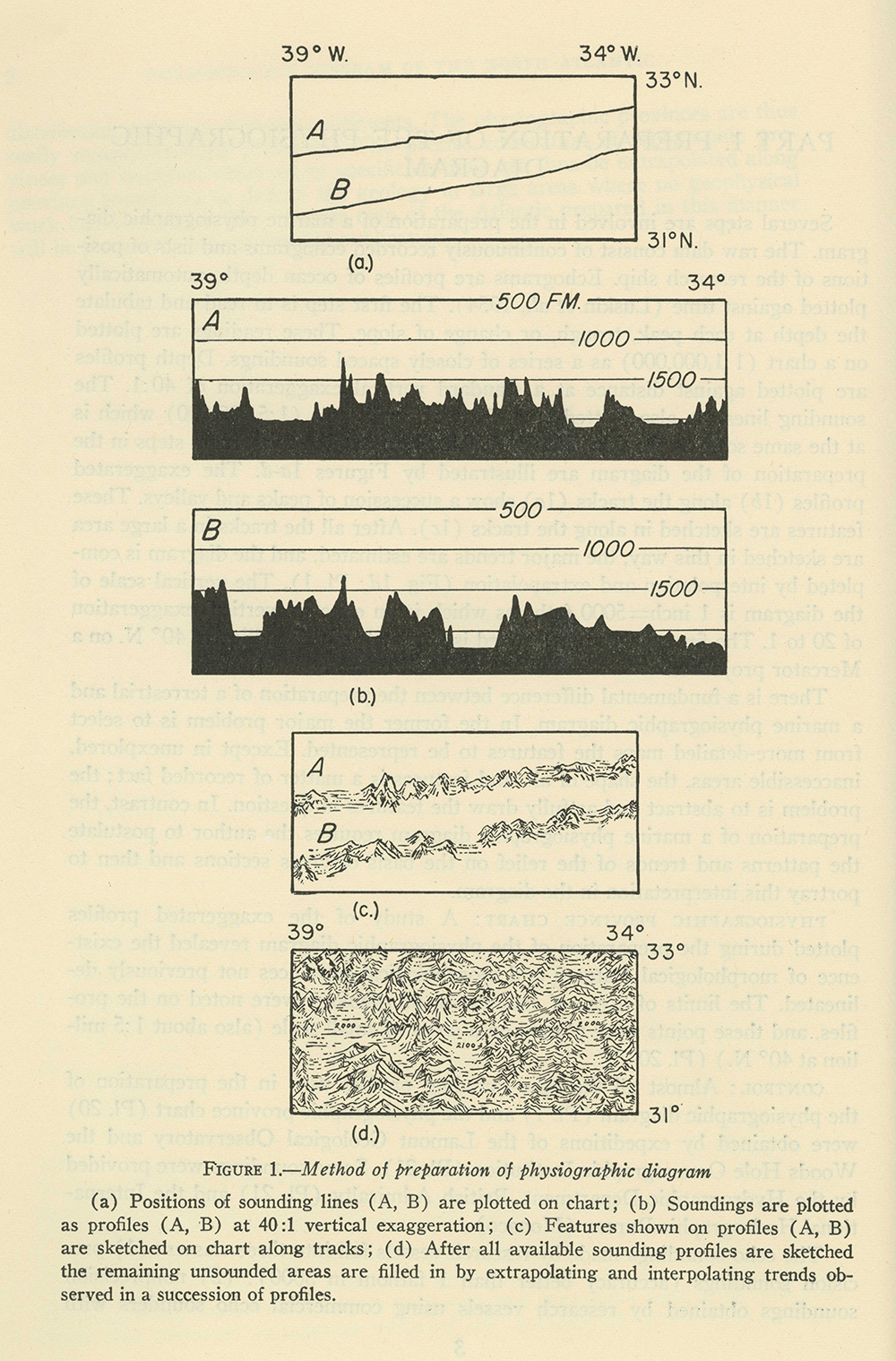
How do you convince the world that the ocean floor actually rumbles with a tumultuous topography? Oceanographer Marie Tharp discarded contour and hachure lines for a method that blended sonar data and pictorial mapping. Its foundation, though, was still a line. As these diagrams explain, Tharp turned data taken along the surveying ship’s path into an exaggerated, jagged elevation. These lines, extrapolated and rendered pictorially to fill the whole map, enlivened the newly discovered Mid-Atlantic Ridge.