The Persistence of Nahua Culture
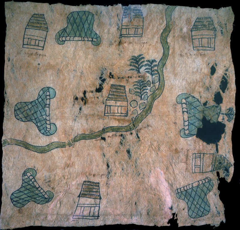
This map combines both indigenous methods of conveying information, and clearly non-indigenous modes of depiction. Traditional indigenous place signs in the shape of hills (tepetl) alternate with straw thatched houses (xacalli) around the edge of the map. A wavy band curving from top to left suggests a river, although no signs for water are included; irregular “rocks” and fir trees are beside a house alongside the “river.” Among the illegible notations under most of the houses and hill-signs, pueblo [p°; town] can be faintly seen. The non-indigenous style of rocks, trees, and water suggests a late date or an artist not fully conversant with indigenous pictographs.
Newberry Library: Vault oversize Ayer MS 1903