The Persistence of Nahua Culture
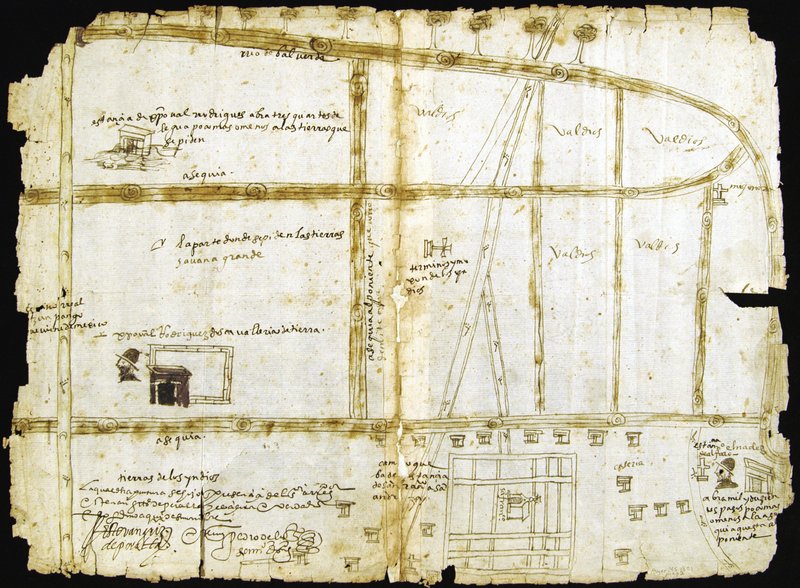
This map probably accompanied recorded litigation between local indigenous communities over the sale of a property to a Spaniard and the problem of possession and use of Lake Xaltocan for irrigation. Irrigation ditches (asequias) feature prominently in this map in which the lower third is “Indian land” (tierras de los yndios); native style houses surround the grid plan town of San Francisco [Tenopalco] marked by its church. On the right, crosses mark the boundaries of Indian land labeled “empty” (valdios). At left, Cristóbal Rodríguez is depicted, his large hacienda above. The notation by his head reads “the part where he is asking for the lands. Large plain” (“la parte donde se piden las tierras. Savana grande”).
Newberry Library: Ayer MS 1801 Map 2