The Persistence of Nahua Culture
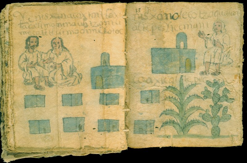
A Techialoyan, the Codex Zempoala describes the land and records the names, acreage, and boundaries of Zempoala’s districts. Churches, city halls, and houses of tribute-payers are depicted. Also shown are the principal crops cultivated in the area: the maguey plant and nopal cactus. The left page of this document invokes prehispanic origins of ownership through the depiction of the mountain (Tzinquilocantepetl) which established the boundary, and Ixtlilxochitl, royal ancestor and Cortés’ ally. On the right page, the noble lord and chief Tecpancacaltzin and his son Xilomantzin are depicted.
Newberry Library: Vault Ayer MS 1472