The Persistence of Nahua Culture
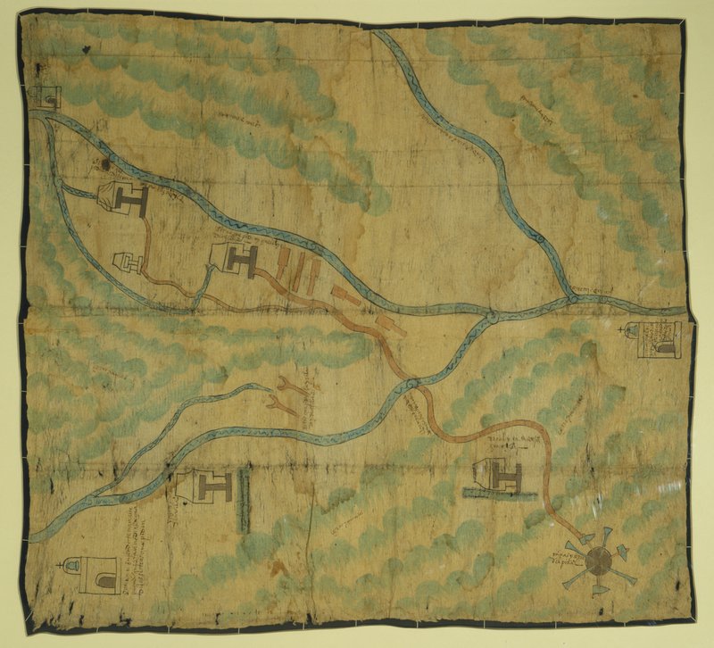
This map of the mining district of the Temascaltepec region (central Mexico) was probably made for the Spaniards Luis de León and Miguel Luis de Acevedo as part of their legal petition to take possession of two properties on the right (indicated by houses; the Spaniards’ request is noted on the map). Churches mark the nearby towns of San Martín, San Miguel Yxtapan, and Santa María. However, indigenous-style pictographs are used to represent the important landscape features. The mines are represented at the lower left; paddle-like copper tools are at the map's center; and the two indigenous houses on the left are ore refineries. Other features, such as hills and mountains, streams with wavy lines and swirls, and roads with footprints are easily recognizable.
Newberry Library: Vault oversize Ayer MS 1906