The Historical Geography of Transportation Map 10 - Turnpikes, Canals and Railroads in the United States, 1835
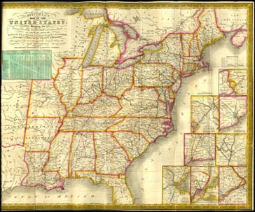
Core Map: Mitchell's Map of the United States. Philadelphia: S. Augustus Mitchell, 1835. Newberry Library call number: H6083.58
A map published for travelers in the United States in 1835 provides the background for lessons examining the nature and extent of transportation systems at the height of the canal era. The lessons build transportation map reading skills and examine the role of transportation systems in the development and settlement of the country's original "West"-the lands between the Appalachian Mountains and the Mississippi River.