| |
The Occidental Tourist: 500 Years of Orienting Maps |
| |
Positioning
north at the top of the page has, over time, become conventional on
maps. The primacy of this north-up orientation on most maps likely
originated with the recognition of the absolute direction of Polaris,
and, after 1450, the prevalence of compass use, focused northward. But
not all maps are oriented in this tradition. |
| |
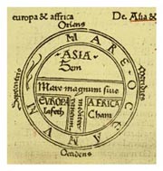
 The
1532 Mappamundi of Isidore of Seville has an east-up orientation,
emerging out of the tradition of “T-in-O” maps. Numerous medieval
Christian maps used this orientation to reinforce the Old Testament
division of the post-flood world into three parts. The east-up
orientation also allows the positioning of the Christ figure with the
head “oriented” to the east. The
1532 Mappamundi of Isidore of Seville has an east-up orientation,
emerging out of the tradition of “T-in-O” maps. Numerous medieval
Christian maps used this orientation to reinforce the Old Testament
division of the post-flood world into three parts. The east-up
orientation also allows the positioning of the Christ figure with the
head “oriented” to the east.
|
| |
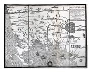
 The
first map drawn, engraved, and printed in America, John Foster’s 1677
woodcut of New England, accompanied Rev. William Hubbard's book on King
Philip’s War. While its prototypes were north-up, the map is oriented
west-up because its English audience would have regarded the New World
from the east. Also, for the settlers, the land to the west was a
region of conflict and wilderness. Historic expansion in this region
was westward, and the orientation draws the eye up in the direction of
that movement. The
first map drawn, engraved, and printed in America, John Foster’s 1677
woodcut of New England, accompanied Rev. William Hubbard's book on King
Philip’s War. While its prototypes were north-up, the map is oriented
west-up because its English audience would have regarded the New World
from the east. Also, for the settlers, the land to the west was a
region of conflict and wilderness. Historic expansion in this region
was westward, and the orientation draws the eye up in the direction of
that movement.
|
| |
 The
“upside-down” map is consciously disorienting, designed to aid
travelers of the 1950s, many of whom were Northerners traveling to
south to Florida. The south-up orientation mimics the landscape at the
moment of use, allowing left and right turns to match the turns on the
map. Seeking additional profit, Esso asked consumers to buy a
“regularly” oriented map for travel back north. The
“upside-down” map is consciously disorienting, designed to aid
travelers of the 1950s, many of whom were Northerners traveling to
south to Florida. The south-up orientation mimics the landscape at the
moment of use, allowing left and right turns to match the turns on the
map. Seeking additional profit, Esso asked consumers to buy a
“regularly” oriented map for travel back north.
|
| |
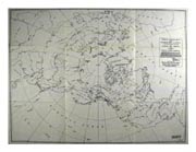
 The
“Great Circle Map Showing Fairbanks, Alaska” map is a polar projection
with no apparent orientation, but the positioning of Fairbanks, the
focus of the map, in the lower center of the map, and the Alaska-facing
Eurasian test, suggests that north is “up,” but for unconventional
reasons. Here, the reader is asked to consider Alaska’s strategic
proximity to areas such as northern Europe toward which the logical
direction to navigate would be north, and not southeast, as
normal-aspect cylindrical projections would lead one to believe. The
“Great Circle Map Showing Fairbanks, Alaska” map is a polar projection
with no apparent orientation, but the positioning of Fairbanks, the
focus of the map, in the lower center of the map, and the Alaska-facing
Eurasian test, suggests that north is “up,” but for unconventional
reasons. Here, the reader is asked to consider Alaska’s strategic
proximity to areas such as northern Europe toward which the logical
direction to navigate would be north, and not southeast, as
normal-aspect cylindrical projections would lead one to believe.
|
| |
![[Nahuatl glyph map of Aztec migration from Aztlan to Tenochtitlán]](/smith/exhibits/narrativesmaps/images/siguenza-th.jpg) This
early 19th-century reproduction of a 16th-century map presents a
cartographic history of the Aztec migration from their mythic homeland
of Aztlán to Tenochtitlán, the site of present-day Mexico City.
Represented by footsteps, the map’s orientation changes as the Aztecs
divide into tribes before arriving in the Valley of Mexico. It is in
the Valley that the map begins to represent roughly the geography of
the area, and the changing orientation of the map thus represents a
journey through time as well as space. This
early 19th-century reproduction of a 16th-century map presents a
cartographic history of the Aztec migration from their mythic homeland
of Aztlán to Tenochtitlán, the site of present-day Mexico City.
Represented by footsteps, the map’s orientation changes as the Aztecs
divide into tribes before arriving in the Valley of Mexico. It is in
the Valley that the map begins to represent roughly the geography of
the area, and the changing orientation of the map thus represents a
journey through time as well as space.
|
| |
- Rob Edsall (Arizona State University)
- Kelli Lyon Johnson (Miami University)
- Alex Zukas (National University)
- Cynthia Millis-Horton (Houston Community College Southwest) |


![[Nahuatl glyph map of Aztec migration from Aztlan to Tenochtitlán]](/smith/exhibits/narrativesmaps/images/siguenza-th.jpg)