| |
Losing Lewis & Clark
|
| |
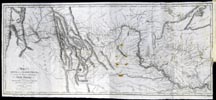
Lewis and Clark are missing! Not their dusty bones, but their legacy. These maps illustrate how Lewis and Clark have been transformed over time from military scouts and scientific researchers into tourist guides for modern America.  As a result of its eight-thousand-mile journey between 1803 and 1806, Lewis and Clark’s Corps of Discovery brought back detailed information on river courses, mountain ranges, flora, and fauna as well as on the locations and populations of native peoples and their social and commercial activities. Captain William Clark recorded his detailed observations and drew a map that summarizes their journey. Samuel Lewis copied and reduced it so the engraved map could be included in Paul Allen’s History of the Expedition Under the Command of Captains Lewis and Clark, published in 1814. The map accurately placed mountain ranges and rivers and has shaped our modern understanding of the topography of the American west. As a result of its eight-thousand-mile journey between 1803 and 1806, Lewis and Clark’s Corps of Discovery brought back detailed information on river courses, mountain ranges, flora, and fauna as well as on the locations and populations of native peoples and their social and commercial activities. Captain William Clark recorded his detailed observations and drew a map that summarizes their journey. Samuel Lewis copied and reduced it so the engraved map could be included in Paul Allen’s History of the Expedition Under the Command of Captains Lewis and Clark, published in 1814. The map accurately placed mountain ranges and rivers and has shaped our modern understanding of the topography of the American west.
|
| |
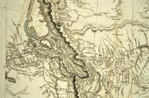
 In 1816, Aaron Arrowsmith, an astute British cartographer and publisher, took the geographical information provided by Lewis and Clark and amalgamated their accounts with data from other reports and expeditions to produce this map. In 1816, Aaron Arrowsmith, an astute British cartographer and publisher, took the geographical information provided by Lewis and Clark and amalgamated their accounts with data from other reports and expeditions to produce this map.
|
| |

In 1900, as the centennial of the expedition approached, another clever businessman, Olin D. Wheeler, a Northern Pacific Railroad executive, published one of the first guidebooks to the Pacific Northwest. His book prominently featured the network of the Northern Pacific Railroad, but it also contained detailed maps of Lewis and Clark’s expedition in relation to the railroads. Highlighted were magnificent wonders on their route such as Yellowstone, which was not actually seen by the Corps of Discovery. |
| |
 2003 saw the launching of the Lewis and Clark Bicentennial Commemoration, sponsored by no fewer than fourteen federal and quasi-federal public agencies and organizations. This map describes the route of the expedition in relation to national landmarks, monuments, wildlife refuges, Indian reservations, and interstate highways. Turning Lewis and Clark into tourist guides for America, this map oversimplifies crucial information about the journey; for example, the point of embarkation neatly begins where the lines denoting “Preparation” and “Recruitment” end, making it appear as if the Corps of Discovery set off from Monticello and smoothly proceeded westward, while ending the exploration at the same point of embarkation. 2003 saw the launching of the Lewis and Clark Bicentennial Commemoration, sponsored by no fewer than fourteen federal and quasi-federal public agencies and organizations. This map describes the route of the expedition in relation to national landmarks, monuments, wildlife refuges, Indian reservations, and interstate highways. Turning Lewis and Clark into tourist guides for America, this map oversimplifies crucial information about the journey; for example, the point of embarkation neatly begins where the lines denoting “Preparation” and “Recruitment” end, making it appear as if the Corps of Discovery set off from Monticello and smoothly proceeded westward, while ending the exploration at the same point of embarkation.
|
| |
-Susan Bazargan (Eastern Illinois University)
-Hugo Freund (Union College)
-Melinda Kashuba (Independent Scholar)
-Wendy St. Jean (Dickinson University)
|


